
| Area: 3.300 Acres | ||
| Lat: 39°38′10″N 121°33′00″W | ||
| Lon: | ||
| Nearby Services | ||
| Site Facilities |
| Join Our Mailing List |
|
For Email Marketing you can trust
|
Top Banner Photo Credits
Gary Skipper
American Pika
Rich Warren
Bullocks Oriole
Cindy Croissant
Yellow-faced Bumble Bee
Samira Furlan
Channel Islands National Park Island Fox
Annette Siegel
Young Oystercatcher
Chih-Hsin Wang
Great Egret
Kaelyn DeYoung
San Joaquin Antelope Squirrel
Gary Skipper
American Pika
Rich Warren
Bullocks Oriole
Cindy Croissant
Yellow-faced Bumble Bee
Samira Furlan
Channel Islands National Park Island Fox
Annette Siegel
Young Oystercatcher
Chih-Hsin Wang
Great Egret
Kaelyn DeYoung
San Joaquin Antelope Squirrel
© 2008-2026 California Watchable Wildlife and SnowlineGraphics.com
| North Table Mountain Ecological Reserve - Site # 5055 | |||
| Livestock grazing has been the major historical land use of the reserve, though beginning in 1848 there was extensive mining activity immediately to the north, east, and south sides of the mountain. The property was acquired by the California Department of Fish & Wildlife in 1993 to preserve the Northern Basalt Flow Vernal Pools habitat type and sensitive species. Funds for this acquisition were provided by Proposition 70, a 1988 voter-approved initiative that designated funds specifically for the acquisition of Significant Natural Areas as identified by the Department. Additional land was acquired in 1997 to enable direct public access from the gravel parking lot on Cherokee Road. The property was designated as an ecological reserve by the Fish & Game Commission in 2003. | |||
 | Regional - worth visiting if you are already in the area. They may be located farther from populated areas or with more limited wildlife species. | ||


| |||
| Background: | Created by ancient lava (basalt) flows, the approximately 3,300 acre North Table Mountain Ecological Reserve is an elevated basalt mesa with beautiful vistas of spring wildflowers, waterfalls, lava outcrops, and a rare type of vernal pool, called Northern Basalt Flow Vernal Pools. Typically fissures in the basalt soak up winter rains, forming seasonal streams and waterfalls. In a few places, however, the underlying basalt is impermeable to water forming a temporary pool. Soon to dry up after rains end, only specialized plants and animals adapted to this habitat can survive over time. | ||
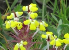
| The Habitat: | Sensitive plant and animal species that occur on the preserve include: Limnanthes floccosa ssp. californica — Butte County meadowfoam Juncus leiospermus var. leiospermus — Red Bluff dwarf rush Phrynosoma coronatum frontale — California horned lizard Trifolium jokerstii – Butte County golden clover. Trees in the ravine habitats include native oaks, madrones, California buckeyes, and California bays. | ||
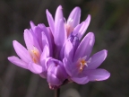
| The Experience: | The reserve protects and preserves the rare Northern Basalt Flow Vernal Pools, a vernal pools habitat type that supports sensitive plants and animals that are either locally endemic, or endemic to California. The Northern Basalt Flow Vernal Pools habitat is found in only four localities within the state. Time and erosion have split the volcanic plateau of Table Mountain into two sections, north and south. There are smaller ravines as well that support various types of trees and woodlands. The top expanse has grasslands with lichen-covered rocks. The winter/spring rains recharge the vernal pools and create waterfalls and wildflower displays. Despite the impacts of non-native invasive plant species, range management practices, such as cattle grazing, have contributed to maintaining spectacular wildflower blooms that draw many visitors from near and far to the North Table Mountain Ecological Reserve. | ||
| Wildlife and Where to Find It: | Birds seen include golden eagle, turkey vulture and peregrine falcon, to the small canyon wren and meadowlark. | ||
| Viewing Tips: | Blooming wildflowers and gushing waterfalls can only mean one thing: spring on North Table Mountain Ecological Reserve! The mesa comes alive in spring when its hillsides explode in color and its seasonal waterfalls are in great form. The largest of them all is 165-foot Phantom Falls, accessed by an easy 4.2-mile (round-trip) hike. Your first stop is Ravine Falls, a good spot for a picnic. A half-mile farther along is the star attraction, Phantom Falls. To reach the falls, follow the path that veers right from the parking lot entrance. Keep walking along the fence line and follow the trail as it veers to the right. Once you pass Ravine Falls, continue to follow signs for Phantom Falls. stream to the left of the parking lot. You’ll soon reach a shaded oak grove; take the fork in the trail to the right and head northeast. You’ll traverse vernal pools and lava outcroppings while surrounded by fields of lupine, buttercups, clover, and poppies. Wildflowers are best through March – April. | ||
| Site Notes: | Please do not approach the cattle closer than 300 feet. Removal of mineral, archaeological, or natural resources in any form is prohibited except as provided in CCR Title 14, §650 Removal or disturbance of any form of plant or animal life is prohibited except as provided in CCR Title 14, §650 No collecting is allowed except as provided in CCR Title 14, §650. Camping is not allowed. Fires of any kind are not allowed including fireworks, or other explosive or incendiary devices. Dogs on the reserve must be retained on a leash of less than 10 feet. Motorized vehicles are prohibited except on designated access roads and parking areas. Any refuse resulting from a person's use of an area must be removed from the area by that person. Horses and bicycles are prohibited from entering the reserve. Drones are prohibited without a Special Use Permit (PDF) | ||
| Nearby Viewing Sites: | Bidwell Park Butte College Wildlife Refuge Chico Seed Orchard Feather River Fish Hatchery Gray Lodge Wildlife Area Lake Oroville State Recreation Area Oroville Wildlife Area | ||
| Festivals & Events: | Oroville Salmon Festival California Swan Festival - Marysville Snow Goose Festival -Chico | ||
| Visitor Information: | Explore Butte County - (530) 918-4585 - www.explorebuttecounty.com | ||
| Viewing Site Hours of Operation are: | |||
| Staff On-site: | No | ||
| Open: | Year round | ||
| Hours: | |||
| Year Round: | |||
| Seasonal: | Summer months are exceedingly hot. Vernal pools and waterfalls dry up. Depending on rain totals will determine how long they last. | ||
| Road Information: | |||
| Road Hazards: | |||
| Parking Fee: Yes | |||
| Proximity to viewing area: | |||
| Parking Danger: Parking at the site is very limited; parking along Cherokee Road near the CDFW parking lot is not permitted and may result in a ticket. Potable water and trash receptacles are not available at the site. Please be prepared to pack out your own trash. Dress for the weather. Hats, sunscreen, snacks, water, and sturdy closed-toe footwear recommended. Trails are not maintained by CDFW and may be rugged, rocky, and steep. Do not, at any time, traverse onto private property that surrounds the reserve. | |||
| Special Tips: | Each visitor to NTMER who is 16 years of age or older is required to carry a daily (1 day) or annual lands pass while on the property. Visitors who are carrying their own valid California hunting or fishing license are exempt from the requirement. School and organized youth groups (including accompanying adults) are also exempt. While guided field trips are not available, educational resources and pre-visit materials may be obtained by contacting Molly.Shea@wildlife.ca.gov For more information: https://wildlife.ca.gov/Licensing/Lands-Pass/FAQ While in the Oroville area, visit the Oregon City covered bridge – one of ten official covered bridges in California and the last bridge built in the state. To get there, continue north along Cherokee Road to Derrick Road (also known as Oregon Gulch Road). Turn right on to Derrick Road. The bridge is roughly a half mile from the intersection with Cherokee Road. CDFW’s Feather River Fish Hatchery in Oroville, which raises salmon and steelhead, is also worth a stop. In the fall and winter, you can watch wild Chinook salmon and steelhead from underwater viewing windows as they make their way up the fish ladder to their spawning grounds. Call (530) 538-2222 for information about best times to visit. Also, look for the Oroville Salmon Festival each September. | ||
| How to Get There: | From Hwy 70 in Oroville. Exit at Grand Ave (Exit 48). Go East (right) on Grand Ave for 1 mile. Left on Table Mountain Blvd for a tenth of a mile. Right on Cherokee Road 6.3 miles north to the reserve. Official access is through a small parking lot on the west side of Cherokee Road. | ||
| Contact Information | |||
| Managing Agency: | California Department of Fish & Wildlife | ||
| Agency Site URL: | https://wildlife.ca.gov/Lands/Places-to-Visit/North-Table-Mountain-ER | ||
| Physical Address: | Rancho Cordova, CA |
Agency 2: | Chico, CA |
| Manager Phone: | (916) 358-2869 - CDFW | Contact Us: | by Email |
| Site Phone: | (530) 918-4585 - Explore Butte County | ||
| County: | Butte | ||
| Addition Website: | www.explorebuttecounty.com | ||
